
A GIS-Based Comparative Analysis of Ground Water Quality in Administrative Towns of Lahore City (2014–2024)
Keywords:
Comparative Analysis, Entropy Weighted Model, Groundwater Quality, GISAbstract
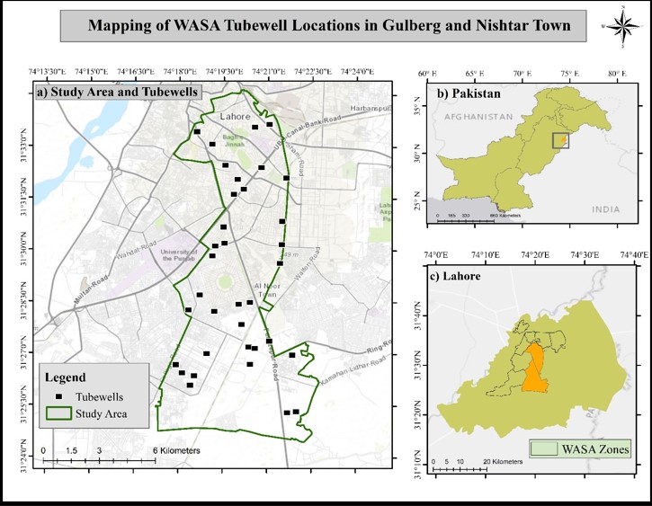
Amidst insufficiency of water reserves, groundwater plays a crucial role in meeting freshwater requirements for households, parks, and horticulture in Lahore city. However, concerns regarding groundwater quality and its associated risk to human health and the environment have intensified due to factors such as rapid urbanization, industrial growth, and over extraction. Despite different monitoring efforts, the regional variability and uncertainty in groundwater quality necessitate more sophisticated assessment approaches to support optimal decision-making. The purpose of this study is to perform a comparative analysis between traditional Groundwater Quality Index (GQI) evaluation methods and entropy-weighted models. Additionally, it aims to analyze groundwater quality in tubewells across administrative towns in Lahore by utilizing Geographic Information System (GIS) and advanced geospatial techniques. The study incorporates groundwater quality data such as pH, Total Dissolved Solids (TDS), Electrical Conductivity (EC), and heavy metal concentrations into a GIS-based spatial analytic framework. By taking uncertainty in water quality classification into account, both traditional and entropy information theory offer a more adaptable and practical evaluation of groundwater suitability than the other GQI frameworks. The findings of this study show that groundwater quality varies significantly around Lahore, with certain regions showing contamination levels above acceptable bounds. High-risk areas are identified by the study, where water quality metrics point to possible health issues and highlight the necessity of focused measures.
References
Z. A. & M. B. Maria Latif, Nimra Nasir, Rab Nawaz, Iqra Nasim, Khawar Sultan, Muhammad Atif Irshad, Ali Irfan, Turki M. Dawoud, Youssouf Ali Younous, “Assessment of drinking water quality using Water Quality Index and synthetic pollution index in urban areas of mega city Lahore: a GIS-based approach,” Sci. Rep., vol. 14, p. 13416, 2024, doi: https://doi.org/10.1038/s41598-024-63296-1.
C. Calzolari and F. Ungaro, “Predicting shallow water table depth at regional scale from rainfall and soil data,” J. Hydrol., vol. 414–415, pp. 374–387, 2012, doi: https://doi.org/10.1016/j.jhydrol.2011.11.008.
J. T. S. Buchanan, “Mapping Water Table Depth Using Geophysical and Environmental Variables,” Ground Water, vol. 47, no. 1, p. 1, 2009, doi: https://doi.org/10.1111/j.1745-6584.2008.00490.x.
S. Haydar, M. Arshad, and J. A. Aziz, “Evaluation of Drinking Water Quality in Urban Areas of Pakistan: A Case Study of Southern Lahore,” PJEAS, vol. 5, 2009, [Online]. Available: https://journal.uet.edu.pk/ojs_old/index.php/pjeas/article/view/187
D. M. A. Malik, E. M. Azam, and A. Saboor, “Water quality status of Upper KPK and Northern Areas of Pakistan,” Pakistan Counc. Res. Water Resour. Water Resour. Res. Centre, Peshawar, Minist. Sci. Technol., 2010, [Online]. Available: https://pcrwr.gov.pk/wp-content/uploads/2020/Water-Quality-Reports/Water Quality Status in KPK.pdf
M. A. Kahlown, A. Raoof, M. Zubair, and W. D. Kemper, “Water use efficiency and economic feasibility of growing rice and wheat with sprinkler irrigation in the Indus Basin of Pakistan,” Agric. Water Manag., vol. 87, no. 3, pp. 292–298, Feb. 2007, doi: 10.1016/j.agwat.2006.07.011.
J. I. and M. K. Shahid, Syed Umair, “GIS based Groundwater Vulnerability Assessment of Lahore a Metropolitan using Modified DRASTIC Model,” NUST J. Eng. Sci., vol. 16, no. 2, 2023, [Online]. Available: https://core.ac.uk/download/603680251.pdf
M. M. Akhtar and Zhonghua Tang, “Identification of Contamination Sources and TDS Concentration in Groundwater of Second Biggest City of Pakistan,” Int. J. Environ. Sci. Dev., 2013, [Online]. Available: https://www.ijesd.org/index.php?m=content&c=index&a=show&catid=43&id=657
“Enhancing the groundwater management capacity in Asian cities through the development and application of groundwater sustainability index in the context of global change,” Apr. 2013, doi: 10.30852/P.4465.
T. G. Mueller, N. B. Pusuluri, K. K. Mathias, P. L. Cornelius, R. I. Barnhisel, and S. A. Shearer, “Map Quality for Ordinary Kriging and Inverse Distance Weighted Interpolation,” Soil Sci. Soc. Am. J., vol. 68, no. 6, pp. 2042–2047, Nov. 2004, doi: 10.2136/SSSAJ2004.2042.
Benedikt Gr¨aler, “cokriging and indicator kriging,” Semin. Spat. Depend., 2011, [Online]. Available: http://www.graeler.org/copulaIntro/02_Co-Kriging_Indicator-Kriging.pdf
Q. Wang, P. M. Atkinson, and W. Shi, “Indicator cokriging-based subpixel mapping without prior spatial structure information,” IEEE Trans. Geosci. Remote Sens., vol. 53, no. 1, pp. 309–323, 2015, doi: 10.1109/TGRS.2014.2321834.
N. G. Vinod Kothari, Suman Vij, SuneshKumar Sharma, “Correlation of various water quality parameters and water quality index of districts of Uttarakhand,” Environ. Sustain. Indic., vol. 9, p. 100093, 2021, doi: https://doi.org/10.1016/j.indic.2020.100093.
M. S. U. Hasan and A. K. Rai, “Groundwater quality assessment in the Lower Ganga Basin using entropy information theory and GIS,” J. Clean. Prod., vol. 274, p. 123077, 2020, doi: https://doi.org/10.1016/j.jclepro.2020.123077.
U. Shahid, “Groundwater Vulnerability Assessment of Lahore City based on Modified DRASTIC Model in GIS,” 2017.
N. N. Maria Latif, “Assessment of drinking water quality using Water Quality Index and synthetic pollution index in urban areas of mega city Lahore: a GIS-based approach,” Sci. Reports Vol., vol. 14, 2024, [Online]. Available: https://www.nature.com/articles/s41598-024-63296-1
S. Haydar, M. Arshad, and J. A. Aziz, “Evaluation of Drinking Water Quality in Urban Areas of Pakistan: A Case Study of Southern Lahore,” Pakistan J. Eng. Appl. Sci., vol. 5, 2009, [Online]. Available: https://journal.uet.edu.pk/ojs_old/index.php/pjeas/article/view/187
Downloads
Published
How to Cite
Issue
Section
License
Copyright (c) 2025 50sea

This work is licensed under a Creative Commons Attribution 4.0 International License.


