
Python and GLO-DEM Pixel-Based Hypsometry in Upper Indus Basin
Keywords:
Hypsometric Integral, Hypsometric Curve, Global Moran’s I, Getis-Ord Gi* Statistic, Upper Indus BasinAbstract
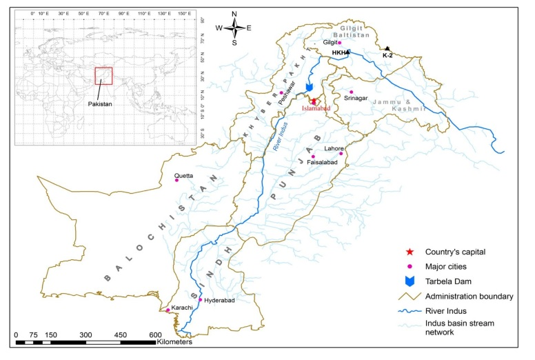
Northern Pakistan’s Hunza and Shyok headwaters, where the Karakoram, Himalaya, and Hindukush ranges converge, host some of the largest mid-latitude valley glaciers outside the polar regions and play a decisive role in runoff and hazards of the Upper Indus Basin. Hypsometry provides a rapid, terrain-based approach to assess basin condition in such high mountain settings. In this study, a 30 m digital elevation model was used to delineate 31 sub-catchments, and for each unit, the hypsometric curve and hypsometric integral (HI) were derived. Methods were kept consistent across scales, with HI also recalculated on 1-4 km grid tiles, and spatial organisation tested through Global Moran’s I and the Getis-Ord Gi* statistic. Results reveal coherent belts of high HI aligned with the Main Karakoram Thrust, the Main Mantle Thrust, and the Karakoram Fault, indicating actively rising terrain and focused incision. Lower HI corridors occur in wider valley floors and recent fills, reflecting more mature landscapes and enhanced storage. HI distributions remain stable across tile sizes with mean values below one-half, while significant clustering confirms that these belts are intrinsic terrain signals. Harder crystalline and intrusive lithologies show higher HI on average, though wide variance suggests the combined influence of structure, rock strength, and relief. These geomorphic patterns carry direct hydrological meaning: high-HI belts imply fast translation of snow and ice melt with sharper seasonal peaks, whereas low-HI corridors favour storage and delay. Hypsometry, therefore, offers a cost-effective and reproducible tool for identifying active belts and providing priors for hydrological modelling and hazard planning in the Upper Indus Basin.
References
A. Ashraf, R. Naz, and R. Roohi, “Glacial lake outburst flood hazards in Hindukush, Karakoram and Himalayan Ranges of Pakistan: implications and risk analysis,” Geomatics, Nat. Hazards Risk, vol. 3, no. 2, pp. 113–132, Jun. 2012, doi: 10.1080/19475705.2011.615344.
J. F. Shroder, N. Eqrar, H. Waizy, H. Ahmadi, and B. J. Weihs, “Review of the Geology of Afghanistan and its water resources,” Int. Geol. Rev., vol. 64, no. 7, pp. 1009–1031, Apr. 2022, doi: 10.1080/00206814.2021.1904297.
A. B. S. Francesca Pellicciotti, Cyrill Buergi, Walter Willem Immerzeel, Markus Konz, “Challenges and Uncertainties in Hydrological Modeling of Remote Hindu Kush–Karakoram–Himalayan (HKH) Basins: Suggestions for Calibration Strategies,” Mt. Res. Dev., vol. 32, no. 1, pp. 39–50, 2012, doi: https://doi.org/10.1659/MRD-JOURNAL-D-11-00092.1.
S. R. Bajracharya and B. Shrestha, “The Status of Glaciers in the Hindu Kush-Himalayan Region,” 2011, doi: 10.53055/ICIMOD.551.
J. Birkmann and K. von Teichman, “Integrating disaster risk reduction and climate change adaptation: Key challenges-scales, knowledge, and norms,” Sustain. Sci., vol. 5, no. 2, pp. 171–184, May 2010, doi: 10.1007/S11625-010-0108-Y/METRICS.
B. Rasul, G., & Ahmad, “climate change in pakistan,” Pakistan Meteorol. Dep., 2012, [Online]. Available: https://scp.gov.pk/Conference2024/downloads/Climate_Chage_in_Pakistan.pdf
A. Amin et al., “Regional climate assessment of precipitation and temperature in Southern Punjab (Pakistan) using SimCLIM climate model for different temporal scales,” Theor. Appl. Climatol., vol. 131, no. 1–2, pp. 121–131, Jan. 2018, doi: 10.1007/S00704-016-1960-1/METRICS.
(IPCC), “Climate Change 2022 – Impacts, Adaptation and Vulnerability,” Intergov. Panel Clim. Chang., 2023, doi: https://doi.org/10.1017/9781009325844.
X. C. Yi Luo, Jeff Arnold, Shiyin Liu, Xiuying Wang, “Inclusion of glacier processes for distributed hydrological modeling at basin scale with application to a watershed in Tianshan Mountains, northwest China,” J. Hydrol., vol. 477, pp. 72–85, 2013, doi: https://doi.org/10.1016/j.jhydrol.2012.11.005.
H. A. & N. K. Sadia Mariam Malik, “Mapping vulnerability to climate change and its repercussions on human health in Pakistan,” Global. Health, vol. 8, 2012, doi: https://doi.org/10.1186/1744-8603-8-31.
A. A. Tahir, P. Chevallier, Y. Arnaud, and B. Ahmad, “Snow cover dynamics and hydrological regime of the Hunza River basin, Karakoram Range, Northern Pakistan,” Hydrol. Earth Syst. Sci., vol. 15, no. 7, pp. 2275–2290, 2011, doi: 10.5194/HESS-15-2275-2011.
M. A. Nick Watts, “The 2018 report of the Lancet Countdown on health and climate change: shaping the health of nations for centuries to come,” Lancet, vol. 392, no. 10163, pp. 2479–2514, 2018, [Online]. Available: https://www.thelancet.com/journals/lancet/article/PIIS0140-6736(18)32594-7/fulltext
N. Chettri et al., “Changing Paradigm in Transboundary Landscape Management: A Retrospect from the Hindu Kush Himalaya,” Sustain. Dev. Goals Ser., vol. Part F2672, pp. 639–656, 2022, doi: 10.1007/978-3-030-70238-0_31.
S. G.-C. Stefan Schneiderbauer, Paola Fontanella Pisa, Jess L. Delves, Lydia Pedoth, Samuel Rufat, Marlene Erschbamer, Thomas Thaler, Fabio Carnelli, “Risk perception of climate change and natural hazards in global mountain regions: A critical review,” Sci. Total Environ., vol. 784, p. 146957, 2021, doi: https://doi.org/10.1016/j.scitotenv.2021.146957.
D. B. Meghnath Dhimal, “Impact of Climate Change on Health and Well-Being of People in Hindu Kush Himalayan Region: A Narrative Review,” Front. Physiol., 2021, doi: https://doi.org/10.3389/fphys.2021.651189.
M. A. Khan, J. A. Khan, Z. Ali, I. Ahmad, and M. N. Ahmad, “The challenge of climate change and policy response in Pakistan,” Environ. Earth Sci. 2016 755, vol. 75, no. 5, pp. 1–16, Feb. 2016, doi: 10.1007/S12665-015-5127-7.
M. G. Thomas Kohler, “Mountains and Climate Change: A Global Concern,” Mt. Res. Dev., vol. 30, no. 1, pp. 53–55, 2010, doi: https://doi.org/10.1659/MRD-JOURNAL-D-09-00086.1.
P. Edward, K. A., & Nicholas, “Active tectonics: earthquakes, uplift, and landscape,” New Jersey Prentice Hall, 2022, [Online]. Available: https://www2.irsm.cas.cz/ext/ethiopia/materials/papers/tectonic_geomorphology/Active tectonics_Keller_Pinter_small.pdf
J. Gilany, S. N. A., & Iqbal, “Geospatial analysis of glacial hazard prone areas of Shigar and Shayok basins,” Int. J. Innov. Appl. Stud., vol. 14, no. 3, p. 623, 2016, [Online]. Available: https://www.researchgate.net/publication/339148981_GEOSPATIAL_ANALYSIS_OF_GLACIAL_HAZARD_PRONE_AREAS_OF_SHIGAR_AND_SHAYOK_BASINS
R. G. Syed Amer Mahmood, “Appraisal of active tectonics in Hindu Kush: Insights from DEM derived geomorphic indices and drainage analysis,” Geosci. Front., vol. 3, no. 4, pp. 407–428, 2012, doi: https://doi.org/10.1016/j.gsf.2011.12.002.
R. J. P. S. E. WILSON, “Elevation-Relief Ratio, Hypsometric Integral, and Geomorphic Area-Altitude Analysis,” Geol. Soc. Am. Bull., vol. 82, no. 4, pp. 1079–1084, 1971, [Online]. Available: https://pubs.geoscienceworld.org/gsa/gsabulletin/article/82/4/1079/7165/Elevation-Relief-Ratio-Hypsometric-Integral-and
J. Qureshi, S. A. Mahmood, A. Masood, P. Khalid, and I. S. Kaukab, “DEM and GIS-based hypsometric analysis to study tectonics and lithologies in southern Suleiman fold and thrust belt (Balochistan–Pakistan),” Arab. J. Geosci., vol. 12, no. 5, pp. 1–15, Mar. 2019, doi: 10.1007/S12517-019-4283-6/METRICS.
S. A. SCHUMM, “EVOLUTION OF DRAINAGE SYSTEMS AND SLOPES IN BADLANDS AT PERTH AMBOY, NEW JERSEY,” Geol. Soc. Am. Bull., vol. 67, no. 5, pp. 597–646, 1956, [Online]. Available: https://pubs.geoscienceworld.org/gsa/gsabulletin/article/67/5/597/4811/EVOLUTION-OF-DRAINAGE-SYSTEMS-AND-SLOPES-IN
J. A. Dipietro, A. Hussain, I. Ahmad, and M. A. Khan, “The main mantle thrust in Pakistan: Its character and extent,” Geol. Soc. Spec. Publ., vol. 170, pp. 375–393, 2000, doi: 10.1144/GSL.SP.2000.170.01.20.
R. Khan, K., Ashraf, C. M., & Faridi, “Climate Change Effect On the Hunza Lake and Geomorphologic Status Of the Hunza River Basin, Gilgit-Baltistan, Pakistan,” 14th World Lake Conf. Austin, 2011, [Online]. Available: https://www.pref.ibaraki.jp/soshiki/seikatsukankyo/kasumigauraesc/04_kenkyu/kaigi/docments/kosyou/14/2011wlc_Khalidakhan.pdf
D. G. Andrea Zanchi, “Multistage structural evolution of Northern Karakorum (Hunza region, Pakistan),” Tectonophysics, vol. 260, no. 1–3, pp. 145–165, 1996, doi: https://doi.org/10.1016/0040-1951(96)00081-9.
A. N. STRAHLER, “HYPSOMETRIC (AREA-ALTITUDE) ANALYSIS OF EROSIONAL TOPOGRAPHY,” Geol. Soc. Am. Bull., vol. 63, no. 11, pp. 1117–1142, 1952, [Online]. Available: https://pubs.geoscienceworld.org/gsa/gsabulletin/article/63/11/1117/4477/HYPSOMETRIC-AREA-ALTITUDE-ANALYSIS-OF-EROSIONAL
G. K. Devia, B. P. Ganasri, and G. S. Dwarakish, “A Review on Hydrological Models,” Aquat. Procedia, vol. 4, pp. 1001–1007, 2015, doi: https://doi.org/10.1016/j.aqpro.2015.02.126.
M. A. Malik, A. Q. Dar, and M. K. Jain, “Modelling streamflow using the SWAT model and multi-site calibration utilizing SUFI-2 of SWAT-CUP model for high altitude catchments, NW Himalaya’s,” Model. Earth Syst. Environ., vol. 8, no. 1, pp. 1203–1213, Mar. 2022, doi: 10.1007/S40808-021-01145-0/METRICS.
F. Garee, K.; Chen, X.; Bao, A.; Wang, Y.; Meng, “Hydrological Modeling of the Upper Indus Basin: A Case Study from a High-Altitude Glacierized Catchment Hunza,” Water, vol. 9, no. 1, p. 17, 2017, doi: https://doi.org/10.3390/w9010017.
Z. Ahmad, M. Hafeez, and I. Ahmad, “Hydrology of mountainous areas in the upper Indus Basin, Northern Pakistan with the perspective of climate change,” Environ. Monit. Assess., vol. 184, no. 9, pp. 5255–5274, Sep. 2012, doi: 10.1007/S10661-011-2337-7/METRICS.
R. Bhambri, T. Bolch, P. Kawishwar, D. P. Dobhal, D. Srivastava, and B. Pratap, “Heterogeneity in glacier response in the upper Shyok valley, northeast Karakoram,” Cryosphere, vol. 7, no. 5, pp. 1385–1398, 2013, doi: 10.5194/TC-7-1385-2013.
T. Kohler and D. Maselli, “Mountains and climate change: From understanding to action,” 2009. Accessed: Oct. 03, 2025. [Online]. Available: https://lib.icimod.org/records/10dry-fv255
L. H. & L. X. Jingshi Liu, Shichang Kang, Kenneth Hewitt, “Large observational bias on discharge in the Indus River since 1970s,” Sci. Rep., vol. 8, 2018, doi: https://doi.org/10.1038/s41598-018-35600-3.
E. A. Keller and N. Pinter, Active tectonics : earthquakes, uplift, and landscape, 2nd ed. Upper Saddle River (N.J.): Prentice Hall, 2002.
Y. C. Chen, Q. Sung, and K. Y. Cheng, “Along-strike variations of morphotectonic features in the Western Foothills of Taiwan: tectonic implications based on stream-gradient and hypsometric analysis,” Geomorphology, vol. 56, no. 1–2, pp. 109–137, Nov. 2003, doi: 10.1016/S0169-555X(03)00059-X.
Downloads
Published
How to Cite
Issue
Section
License
Copyright (c) 2025 50sea

This work is licensed under a Creative Commons Attribution 4.0 International License.


