
Delineation of Drainage Network and Estimation of Total Discharge using Digital Elevation Model (DEM)
DOI:
https://doi.org/10.33411/ijist/20190102011Keywords:
Digital Elevation Model, Drainage Network, Discharged, Sustainable development; Water filtration plants.Abstract
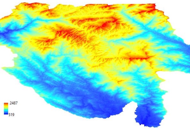
The rapid urbanization and the population growth, have increased the demands of fresh water to manage various tasks from domestic to industrial scales. Various man driven sectors such as agriculture, industry and water filtration plants, require fresh water to cater the need of increasing population. Therefore, the management of available fresh water reservoirs is of great importance to save water for a sustainable future “save water save life”. Digital elevation model (DEM) is efficient to extract the drainage network, basin boundaries and to evaluate the volume of fresh water available in study site. We used Arc hydro tools in Arc GIS interface for extraction of drainage network in the study site. Flow direction and accumulation were computed according to Z-value of individual pixel available in the raster grid. A total 127 streams were extracted against 127 catchments. We observed that the catchments bearing steep slopes were incised in comparison to gentle slopes which were mostly eroded. We evaluated the total discharge in cusec using Q=CIA, where the coefficient ‘C’ of rainfall was substituted as 0.76 for each catchment having rocky soil type. The total discharge was estimated as 10871 cusec. GIS tools proved efficient to map watershed in the study site.
Published
How to Cite
Issue
Section
License
Copyright (c) 2019 50Sea

This work is licensed under a Creative Commons Attribution 4.0 International License.


