Flood Risk Assessment Using Geospatial Techniques: A Case Study of River Ravi-Punjab-Pakistan
Keywords:
Hec-RAS, SRTM, DEM, Flood Damage AssessmentAbstract
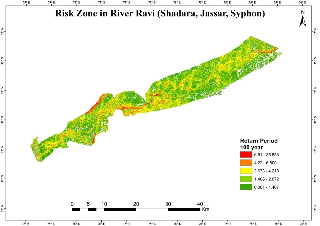
Flooding, an increasingly prevalent environmental hazard, has been worsened by climate change, particularly affecting developing countries. Pakistan is especially vulnerable to hydrological hazards. This study aims to evaluate flood risk using geospatial technology and analyze return periods to assess the impacts of floods on crops. Water is a significant driver of landscape change. Landsat 8 datasets are utilized to examine crop patterns and built-up areas. Return periods of 50, 100, and 250 years are used to define risk zones, with gauges at Jassar, Syphon, and Shahdara considered. Historical images from 1995, 1996, and a recent year are analyzed to track changes in crop and built-up areas. SRTM and Pulsar DEM data are employed to study the watershed. The analysis indicates that over a 150-year period, the probability of a significant flood event is 0.25. This low probability suggests minimal water flow, with only small amounts arriving during the monsoon season, causing minimal disruptions to crops. These probabilities are based on established methodologies. While the probability of a significant flood event over 250 years is very low, it is included for classification purposes. The chance of a flood affecting crop patterns is 0.5, but this may vary if river water levels rise due to other sources. Nonetheless, current data and historical records indicate that the likelihood of floods significantly impacting crop patterns remains very low.
References
“Attitude and perception of tourists in Karnataka towards Climate Change · CHRIST (Deemed To Be University) Institutional Repository.” Accessed: Jul. 29, 2024. [Online]. Available: https://archives.christuniversity.in/items/show/1564
S. Das, “Geographic information system and AHP-based flood hazard zonation of Vaitarna basin, Maharashtra, India,” Arab. J. Geosci., vol. 11, no. 19, pp. 1–13, Oct. 2018, doi: 10.1007/S12517-018-3933-4/METRICS.
H. M. Lyu, W. J. Sun, S. L. Shen, and A. Arulrajah, “Flood risk assessment in metro systems of mega-cities using a GIS-based modeling approach,” Sci. Total Environ., vol. 626, pp. 1012–1025, Jun. 2018, doi: 10.1016/J.SCITOTENV.2018.01.138.
R. Costache and L. Zaharia, “Flash-flood potential assessment and mapping by integrating the weights-of-evidence and frequency ratio statistical methods in GIS environment – Case study: Bâsca chiojdului river catchment (Romania),” J. Earth Syst. Sci., vol. 126, no. 4, pp. 1–19, Jun. 2017, doi: 10.1007/S12040-017-0828-9/METRICS.
Y. Chen et al., “A spatial assessment framework for evaluating flood risk under extreme climates,” Sci. Total Environ., vol. 538, pp. 512–523, Dec. 2015, doi: 10.1016/J.SCITOTENV.2015.08.094.
H. S. Wheater, “Flood hazard and management: a UK perspective,” Philos. Trans. R. Soc. A Math. Phys. Eng. Sci., vol. 364, no. 1845, pp. 2135–2145, Aug. 2006, doi: 10.1098/RSTA.2006.1817.
T. Tsamalashvili, “Flood risk assessment and mitigation measure”.
“Disaster Risk Management Systems in South Asia: Natural Hazards, Vulnerability, Disaster Risk and Legislative and Institutional Frameworks.” Accessed: Jul. 29, 2024. [Online]. Available: https://www.longdom.org/open-access/disaster-risk-management-systems-in-south-asia-natural-hazardsvulnerability-disaster-risk-and-legislative-and-institutional-framew-2167-0587-1000207.pdf
S. Djordjević, D. Butler, P. Gourbesville, O. Mark, and E. Pasche, “New policies to deal with climate change and other drivers impacting on resilience to flooding in urban areas: the CORFU approach,” Environ. Sci. Policy, vol. 14, no. 7, pp. 864–873, Nov. 2011, doi: 10.1016/J.ENVSCI.2011.05.008.
Nouffer and M.M.M., “An Analysis on Flood Mapping and Mitigation for Akkaraipattu Municipal Council Area,” 2014, doi: 10.31357/FHSSMST.2014.00623.

Downloads
Published
How to Cite
Issue
Section
License
Copyright (c) 2024 50SEA

This work is licensed under a Creative Commons Attribution 4.0 International License.


