
Dam Site Identification Using Remote Sensing and GIS (A case study Diamer Basha Dam Site)
DOI:
https://doi.org/10.33411/ijist/20190104122Keywords:
MMT, MKT, MBT,, MMT, MKT, MBT, Suitable sites selection and Geology.Abstract
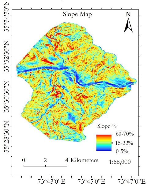
Selection of suitable sites for construction of dam is the most important phase because a number of factors are required to consider that include topography, geology, tectonic settlements and the slope. We selected Diamer Basha dam site to analyze it feasibility considering real-time field data. Geologically the study site is a part of Chilas Mafic Igneous Complex which is not ophiolite. Matic complex is a block which is 40km in depth and 300km in length. These rocks are comparatively hard in nature and are considered good for construction of dam. Tectonically, we observed that the area under investigation was highly active tectonically. Surface deformation rates of the study site are highest throughout the world because this area is comprised of multiple fault lines that include Main Mantle Thurst (MMT), Main Karakoram Thrurst (MKT), Main Boundary Thurst (MBT) and many others. This area has become a hot cake for the geologist worldwide due to it’s very high surface deformation rates.Tectonically active regions are considered worst for construction sites, e.g., for dam sites. The dam site is actcually laying on the MKT which is not favorable for construction of Diamir Basha dam. A low-level earthquake may generate small cracks in concrete structure and any leakage of water may produce big holes with passage of time which are not remidable. A big level earthquake may vanish the dam site completely. Therefore, the current site is not favorable for construction of dam.
References
Munyao, J.N. (2010) Use of Satellite Products to Assess Water Harvesting Potential in Remote Areas of Africa: A Case Study of Unguja Island. Enschede, The Netherlands.
Dorfeshan, F., Heidarnejad, M. and Bo, A. (2014) Locating Suitable Sites for Construction of Underground Dams through Analytic Hierarchy Process. International Conference on Earth, Environment and Life Sciences (EELS-2014), Dubai (UAE),23-24 December 2014, 86-90.
Abushandi, E. and Alatawi, S. (2015) Dam Site Selection Using Remote Sensing Techniques and Geographical Information System to Control Flood Events in Tabuk City. Hydrology: Current Research.
Beavers Advisory Committee for England. (2017) Site Selection Criteria. https://beaversinengland.com/reintroductions/release-site-selection criteria/
Ghazal, N.K. and Salman, S.R. (2015) Determining the Optimum Site of Small Dams Using Remote Sensing Techniques and GIS. International Journal of Scientific Engineering and Research (IJSER), 3, 69-73.
Thanoon, H.A. and Ahmed, K.A. (2013) Hydrological Information Extraction for Dams Site Selection Using Remote Sensing Techniques and Geographical Information System. Al-Rafidain Engineering, 21, 102-114.
Xu, C.-Y. (2002) Hydrologic Models. Uppsala University Department of Earth Sciences Hydrology, Uppsala.
Lalhmingliana and Saha, G. (2016) Identification of Suitable Dam Site: A Survey. International Journal of Computer Engineering & Technology (IJCET), 7, 56-64.
Manugula, S.S., Veeranna, B. and Patel, S. (2015) Geo-Spatial Data Foundation for Dam Sites. International Journal of Civil Engineering and Technology (IJCIET), 6,61-68.
Dai, X. (2016) Dam Site Selection Using an Integrated Method of AHP and GIS for Decision Making Support in Bortala, Northwest China. Lund University, Lund.
Emiroglu, M.E. (2008) Influences on Selection of the Type of Dam. International Journal of Science & Technology, 3, 173-189.
Lashkaripour, G. and Ghafoori, M. (2002) The Engineering Geology of the TabarakAbad Dam. Engineering Geology, 66, 233-239. https://doi.org/10.1016/S0013-7952(02)00044-3
Mati, B. (2017) Water Harvesting and Storage in Valleys Using Small Earth Dams.http://www.jkuat.ac.ke/departments/warrec/wpcontent/uploads/2016/05/Water-harvesting-and-storage-in-Valleys using-Earth-Dams.pdf
Stephens, T. (2010) Manual on Small Earth Dams. A Guide to Siting, Design and Construction. Food and Agriculture Organization of the United Nations, Rome.F. M. Njiru, D. N. Siriba DOI: 10.4236/gep.2018.67009 132 Journal of Geoscience and Environment Protection
Ajin, R.S., Krishnamurthy, R.R.K., Jayaprakash, M. and Vinod, P.G. (2013) Flood Hazard Assessment of Vamanapuram River Basin, Kerala, India: An Approach Using Remote Sensing & GIS Techniques. Advances in Applied Science Research, 4, 263-274.
Ghoraba, S.M. (2015) Hydrological Modeling of the Simly Dam Watershed (Pakistan) Using GIS and SWAT Model. Alexandria Engineering Journal, 54, 583-594.
Engineering Articles (2015) Selection of Dam Site. http://www.engineeringarticles.org/selection-of-dam-site/
Tim, U.S. and Mallavaram, S. (2003) Application of GIS Technology in Watershed-Based Management and Decision Making. Watershed Update, 1, 1-6.
Hosseinzadeh, S.R. (2011) Drainage Network Analysis, Comparis of Digital Elevation Model (DEM) from ASTER with High Resolution Satellite Image and Areal Photographs. International Journal of Environmental Science and Development, 2, 194-198.
Published
How to Cite
Issue
Section
License
Copyright (c) 2019 50Sea

This work is licensed under a Creative Commons Attribution 4.0 International License.


