
Generation of Digital Surface Model (DSM) Using UAV/Quadcopter
DOI:
https://doi.org/10.33411/ijist/2020020304Keywords:
DSM, UAV image high resolution, QuadcopterAbstract
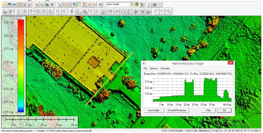
Satellite imageries are being used as primary source of information due to their vast coverage and high temporal resolution. Unnamed Aerial Vehicle (UAV) is being used these days because of its accuracy, autonomous flights, cost effectiveness and rapid overview of data. UAV provides a fully or partially autonomous image acquiring platform which is devoid of any manned flight controller. In this research Phantom 3 advanced Quadcopter was used for an image acquisition plan for generation of Digital Surface Model (DSM). Two designs were drawn through this workflow for the reconstruction of Department of Space Science and technology in university of Punjab. For the first design 3D quadcopter is hovered at the height of 120 feet (37 meters) which covered an area of 83 x 130 meter, frontal and sidewise overlapping is 80%, and the camera is kept at an angle of 70° for the double grid type pattern. For second mission design a circular flight is taken to obtain images at the height of 27meters with coverage area of (107 x 106) meter, 45° camera angle and 10° circular angle. For reconstruction of urban area, quadcopter is hovered at relatively greater height of 210 feet (64 meters), following the double grid pattern. In order to attain desired GST, the camera is flown at a constant height over the Area of Interest (AOI). The highly overlapped images obtained using Phantom 3, advanced Quadcopter are then processed using Pix4d software for processing of images. Initially, the common points of adjacent images are matched automatically. After matching similar points, additional geographic information of coordinates and z-value of elevation associated with it is generated in 3D space by sparse point cloud. Then a detailed 3D model along the precise geo location is obtained using dense point cloud. A study surface area and its texture are generated using 3D mesh. Finally, a desired 3D surface model is accurately generated containing desired AOI. The results are analyzed using UAV imagery to generate high resolution DSM. DSM for construction of urban area of Department of Space Science was generated at a very high resolution of 3.55cm and 1.8cm respectively. The accuracy of geo locations can be improved by using GPS loggers or by taking the GCPs. It is suggested by many authors that 3D surface model of reconstruction of building is quite accurate geographically and geometrically, after the comparison of bundle block adjustments, Ground Sampling Distance (GSD) value, 3D matching and average point cloud density of DSM. Thus, the 3D surface models are used in parameters, features extraction and estimation of values including depth and elevation values, in texturing, 3D data collection for 3D visualizations, 3D roof tops and building facades and contour maps and orthodox photos.
References
D R, Sowmya & Deepa, P. & K., Venugopal, Remote Sensing Satellite Image Processing Techniques for Image Classification: A Comprehensive Survey.
International Journal of Computer Applications, 2017, Vol 161, issue 11, pp: 24-37.
Kuenzer, C. and S. Dech: Thermal Infrared Remote Sensing – Sensors, Methods, Applications. Remote Sensing and Digital Image Processing Series, 2013, Vol 17, pp: 572
Baumann, p. P. History of remote sensing, satellite imagery, part ii. Retrieved from geo/sat 2, history of remote sensing, (2009)
Hassani, Hamid & Mansouri, Anass & Ali, Ahaitouf. Mechanical Modeling, Control and Simulation of a Quadrotor UAV, 2021, pp: 441-449.
Harder, C. B. Creating Mirror Worlds; Enabling a new dimension with 3D imagery. In C. B. Harder, The ArcGIS Imagery Book. Redlands, California: Esri Press, 2016.
Ajayi, Oluibukun & Salubi, Akporode & Angbas, Alu & Odigure, Mukwedeh.. Generation of accurate digital elevation models from UAV acquired low percentage overlapping images. International Journal of Remote Sensing. 2017, Vol 38, issue 8, pp: 1-22.
Lee, Hou-Hsien & Lee, Chang-Jung & Lo, Chih-Ping, Unmanned aerial vehicle and method for controlling the unmanned aerial vehicle, 2013.
de Roos, Shannon & Turner, Darren & Lucieer, Arko & Bowman, David. Using Digital Surface Models from UAS Imagery of Fire Damaged Sphagnum Peatlands for Monitoring and Hydrological Restoration. Drones. 2018, Vol 2, issue 4, Pp:45.
Greenwood, f. Drones and aerial observation: new technologies for property rights, human rights, and global development a primer. New america: valerie altounian, 2015
Lillesand, T. M. REMOTE SENSING AND IMAGE INTERPRET ATION.
United States of America: John Wiley & Sons, 2004
Leishman, J.G. Principles of Helicopter Aerosynamics. New Yorl, NY: Cambridge University Press, (2000).
Published
How to Cite
Issue
Section
License
Copyright (c) 2020 50Sea

This work is licensed under a Creative Commons Attribution 4.0 International License.


