
Novel Technique to Investigate Glacio-Fluvial Hypsometry in Hunza Using Local Indicator of Spatial Autocorrelation (LISA)
Keywords:
SRTM DEM 90m, Global Moran Index, Hypsometry, Spatial auto-correlationAbstract
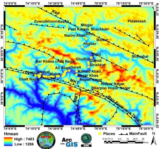
Hypsometric Integral (HI) displays the effect of active tectonics and sensitivity on geomorphic structures. In this study we calculated HI values for Hunza valley to investigate neotectonics, development of topographic structures and process of erosion using SRTM DEM 90m. ArcGIS and MATLAB is used to generate HI and hypsometric curve (HC). We generated HI and HC values by using D8 algorithm in MATLAB to extract drainage basins for 5 and 6 Strahler orders. HI and HC values show the stages of erosion for instance high values of HI and convex HC displays young and tectonically active stage. We used different grid sizes in ArcGIS to calculate maximum, mean and minimum elevation utilizing different statistical techniques. We used Local Indicator of Spatial Autocorrelation (LISA) instead of Global Moran Index to determine the extent of distribution of clustered, dispersed and randomized HI values. This technique indicates high positive z score for auto correlated data. Regions with high HI value indicate relative uplift, undissected and young structures while low HI values indicate sediment accumulation and shallow earthquakes.
References
Eyles, N. and Scheidegger, A. E. ‘Environmental significance of bedrock jointing in Southern Ontario, Canada’. Environmental Geology, vol. 26, pp: 269–77, 1995.
Eyles, N., Arnaud, E., Scheidegger, A. E., and Eyles, C. H. ‘Bedrock jointing and geomorphology in southwestern Ontario, Canada: an example of tectonic predesign’. Geomorphology, vol.19, pp: 17–34, 1997.
Anselin, L. ‘Local indicators of spatial association—LISA’. Geographical Analysis, vol. 27, issue no. 2. Pp: 93-115, 1995.
Chen, Y. C., Sung, Q., and Cheng, K. Y. ( 2003) ‘Along-Strike Variations of Morphotectonics Features in the Western Foothills of Taiwan: Tectonic Implications Based on Stream-Gradient and Hypsometric Analysis’ Geomorphology, vol. 56, issue no. 1-2, pp: 109-137, 2003.
Twidale, C. R. & Campbell, E. M. Australian Landforms: Understanding a Low, Flat, Arid and Old Landscape. Kenthurst, New South Wales: Rosenberg Publishing, 2005.
Diniz-Filho, J. A. F., Bini, L. M., and Hawkins, B. A. ‘Spatial Autocorrelationand Red Herrings in Geographical Ecology’. Global Ecology and Biogeography,vol. 12, issue no. 1, pp: 53–64, 2003.
Gaetani, M., Angiolini, L., Garzanti, E., Jadoul, F., Leven E. Y., Nicora A. & Sciunnach, D. ‘Permain stratigraphy in the Northern Karakorum, Pakistan. ‘Riv. Ital. Pal. Strat., vol. 101, issue no. 2, pp: 107-152, 1995.
Furbish, D.J., & Andrew, J.T. ‘The use of hypsometry to indicate long-term stability and response of valley glaciers to changes in mass transfer’. Journal of Glaciology, vol. 30, issue no. 105, 1984.
Hurtrez, J. & Lucazeau, F. ‘Lithological Control on Relief and Hypsometryin the Herault Drainage Basin (France)’. Comptes Rendus de l’Académie des Sciences—Series IIA—Earth and Planetary Science, vol. 328, issue no. 10, pp: 687–694, 1999.
Hurtrez, J. E., Sol, C., & Lucazeau, F. ‘Effect of Drainage Area on Hypsometry from an Analysis of Small-Scale Drainage Basins in the Siwalik Hills, Central Nepal’. Earth Surface Processes and Landforms, vol. 24, issue no. 9, pp: 799–808, 1999.
Hussain, S.H., & Awan, A.A. ‘Causative Mechanisms of Terrain Movement in Hunza Valley’, report power point slides, viewed 30 August 2014, 2009.
Jan, M.Q., & Kazmi, A.H. ‘Plate tectonics conFigureuration of Gemstones of Pakistan’. Islamabad: Quaid-i-Azam University, 2005.
Keller, E. A., & Pinter, N. Active Tectonics: Earthquakes, Uplift, and Landscape. New Jersey, Prentice Hall, 2002.
Kent, R. (1991) ‘Lithospheric uplift in easternGondwana: evidence for a long-lived mantle plume sys-tem?’. Geology, vol.19, pp:19–23, 1991.
Lifton, N.A. & Chase, C.G. ‘Tectonic, climatic and lithological influences on landscape fractal dimension and hypsometry: implications for landscape evolution in the San Gabriel Mountains, California’. Geomorphology, vol. 5, no. 1–2, pp: 77–114, 1992.
Mahmood, S.A., & Gloaguen, R. ‘Analyzing Spatial Autocorrelation for Hypsometric Integral to Discriminate Neotectonics and Lithologies Using DEMs and GIS’. GIScience and Remote Sensing: John R. Jensen, vol. 48, issue no. 4, 2011.
Mayer, L., Introduction to Quantitative Geomorphology: An Exercise Manual.Englewood Cliffs, NJ, Prentice Hall, 1990.
Moran, P. A. P. ‘Notes on Continuous Stochastic Phenomena’. Biometrika, vol. 37. no. 1–2, pp. 173, 1950
Pike, R. J., & Wilson, S. E. ‘Elevation-Relief Ratio, Hypsometric Integral,and Geomorphic Area-Altitude Analysis’. Geological Society of America Bulletin,vol. 82, no. 4, pp: 1079–1084, 1971.
Pudset, C.J., Schroider, R., Skelton, P.W., & Gupta,V.J., Cretaceous (Aptian/Albian) age for island arc volcanics. Kohistan, N. Pakistan (Contribution to the Himalayan Geology). India, Hindustan Publishing Corporation, 1985.
Ratcliffe, J. H., & McCullagh, M. J. ‘Identifying Repeat Victimization withGIS’. British Journal of Criminology, vol. 38, issue no. 4, pp: 651–662, 1998.
Roohi, R., Dr., Ashraf,A.,Dr., Mustafa, N.,& Mustafa, T. Community Based Survey for Assessment of Glacial Lake Outburst Flood Hazards (GLOFs) in Hunza River Basin. Water Resources Research Institute, National Agricultural Research Centre: Islamabad, 2008.
Scheidegger, A. E. ‘Morphotectonics of eastern Nepal’. Indian Journal of Landscape Systems and Ecological Studies, vol. 22, pp: 1–9, 1999.
Published
How to Cite
Issue
Section
License
Copyright (c) 2021 International Journal of Innovations in Science & Technology

This work is licensed under a Creative Commons Attribution 4.0 International License.


