Appraisal of Spatiotemporal Variations in Snow Cover Dynamics using Geospatial Techniques: A paradigm from Gilgit-Baltistan, Pakistan
DOI:
https://doi.org/10.33411/ijist/2020020408Keywords:
Gilgit Baltistan (GB); Normalized Difference Snow Index (NDSI); Annual fluctuation; Snow-Covered Area (SCA); MODIS imagesAbstract
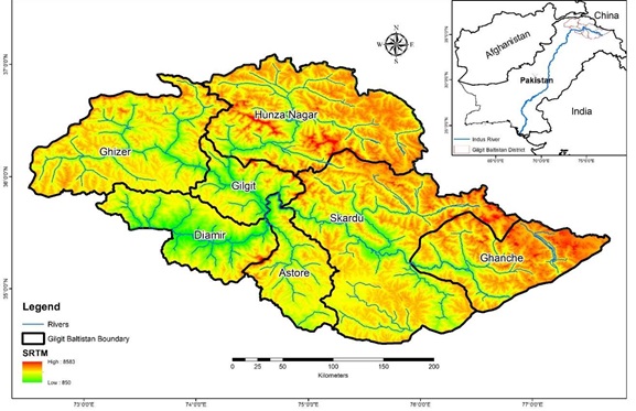
Snow and glaciers in the mountain ranges of Hindu-Kush, Karakoram, and Himalayas (HKH), are supposed to be shrinking. Consequently, serious significances occur in respect of water accessibility for inhabitants of down streams. This investigation is an effort o identify the temporal variation in snow covers of Gilgit Baltistan (GB), northern Pakistan. For the calculation of the Normalized Difference Snow Index (NDSI) and estimation of snow-covered area (SCA), MODIS images for the period of 2000 to 2020 were used. Hunza, Astore, Gilgit, Diamir, Shyok, Ghanche, Skardu and Shigar are major sub-basins lying in GB with Hunza and Skardu being the mostly glaciated areas. Annual fluctuation in snow cover within GB was 10 to 80%. In accumulation season, from December to February, snow cover was almost 80% while in melting season, from July to September this area was reduced to 65-75%. The maximum and minimum Snow-Covered Area (SCA) detected in 2009 was almost 57687.85 km2 and 12083.40 km2 respectively. These results show fluctuations in SCA within the time duration of the last two decades.

Published
How to Cite
Issue
Section
License
Copyright (c) 2020 50Sea

This work is licensed under a Creative Commons Attribution 4.0 International License.


